Overview
The distanceto package is designed to quickly sample distances from points features to other vector layers. Normally the approach for calculating distance to (something) involves generating distance surfaces using raster based approaches eg. raster::distance or gdal_proximity and subsequently point sampling these surfaces. Since raster based approaches are a costly method that frequently leads to memory issues or long and slow run times with high resolution data or large study sites, we have opted to compute these distances using vector based approaches. As a helper, there’s a decidedly low-res raster based approach for visually inspecting your region’s distance surface. But the workhorse is distance_to.
The distanceto package provides two functions:
distance_todistance_raster
Install
# Enable the robitalec universe
options(repos = c(
    robitalec = 'https://robitalec.r-universe.dev',
    CRAN = 'https://cloud.r-project.org'))

# Install distanceto
install.packages('distanceto')
distance_to
library(distanceto)
library(sf)
#> Linking to GEOS 3.9.1, GDAL 3.3.1, PROJ 8.0.1
Long-lat / unprojected coordinates
# Load nc data
nc <- st_read(system.file("shapes/sids.shp", package="spData"))
#> Reading layer `sids' from data source
#>   `/home/alecr/R/x86_64-pc-linux-gnu-library/4.1/spData/shapes/sids.shp'
#>   using driver `ESRI Shapefile'
#> Simple feature collection with 100 features and 22 fields
#> Geometry type: MULTIPOLYGON
#> Dimension:     XY
#> Bounding box:  xmin: -84.32385 ymin: 33.88199 xmax: -75.45698 ymax: 36.58965
#> CRS:           NA
st_crs(nc) <- "+proj=longlat +datum=NAD27"

# Set number of sampling points
npts <- 1e3

# Sample points in nc
ncpts <- st_sample(nc, npts)

# Select first 5 of nc
ncsub <- nc[1:5,]

# Measure distance from ncpts to first 5 of nc
dist <- distance_to(ncpts, ncsub, measure = 'geodesic')

# or add to ncpts
ncpts$dist <- dist

head(dist, 30)
#>  [1]  59159.73 170372.41 239410.32 100642.25 112655.00 219361.44 120556.75
#>  [8] 165470.20  36997.22 204245.47  81224.35 104191.92 175883.53 138352.96
#> [15] 192734.88 146158.76 208500.33 114880.88 164632.04  73676.32 209448.55
#> [22]  82645.85  94063.64 111207.91 114373.67  27710.88 143440.15  10248.95
#> [29]  95629.69 136262.55
hist(dist)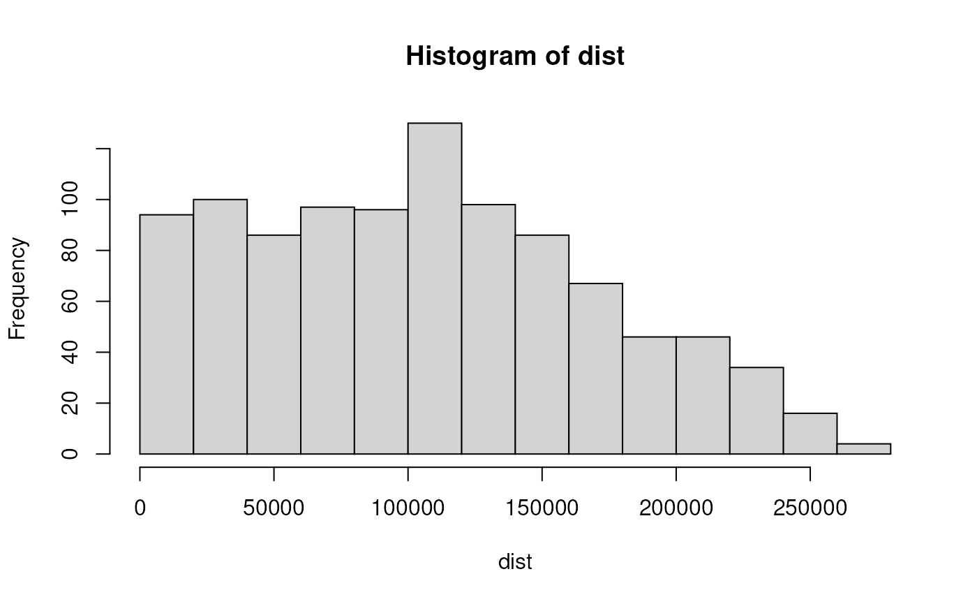
Projected coordinates
# Load seine data
data('seine', package = 'spData')

# Buffer seine by 1000 metres
bufseine <- st_buffer(seine, 1000)

# Set number of sampling points
npts <- 1e2

# Sample points within buffer seine
seinepts <- st_sample(bufseine, npts)

# Measure distance from seine points to seine
dist <- distance_to(seinepts, seine)

# or add to seine points
seinepts$dist <- dist

head(dist, 30)
#>  [1] 1475.4729  804.7909 2965.4492  741.4175 1882.2771  941.2033 1506.2992
#>  [8]  621.2957  579.0929 1643.1096 1581.4075  469.7743  636.9162 1432.3008
#> [15]  574.4903  714.2305  619.2407  596.5574  939.0630 1490.0131  294.1060
#> [22]  631.5090 2691.5918  941.1175  618.8345  959.0653  625.5747  854.7989
#> [29]  719.2472  914.5645
hist(dist)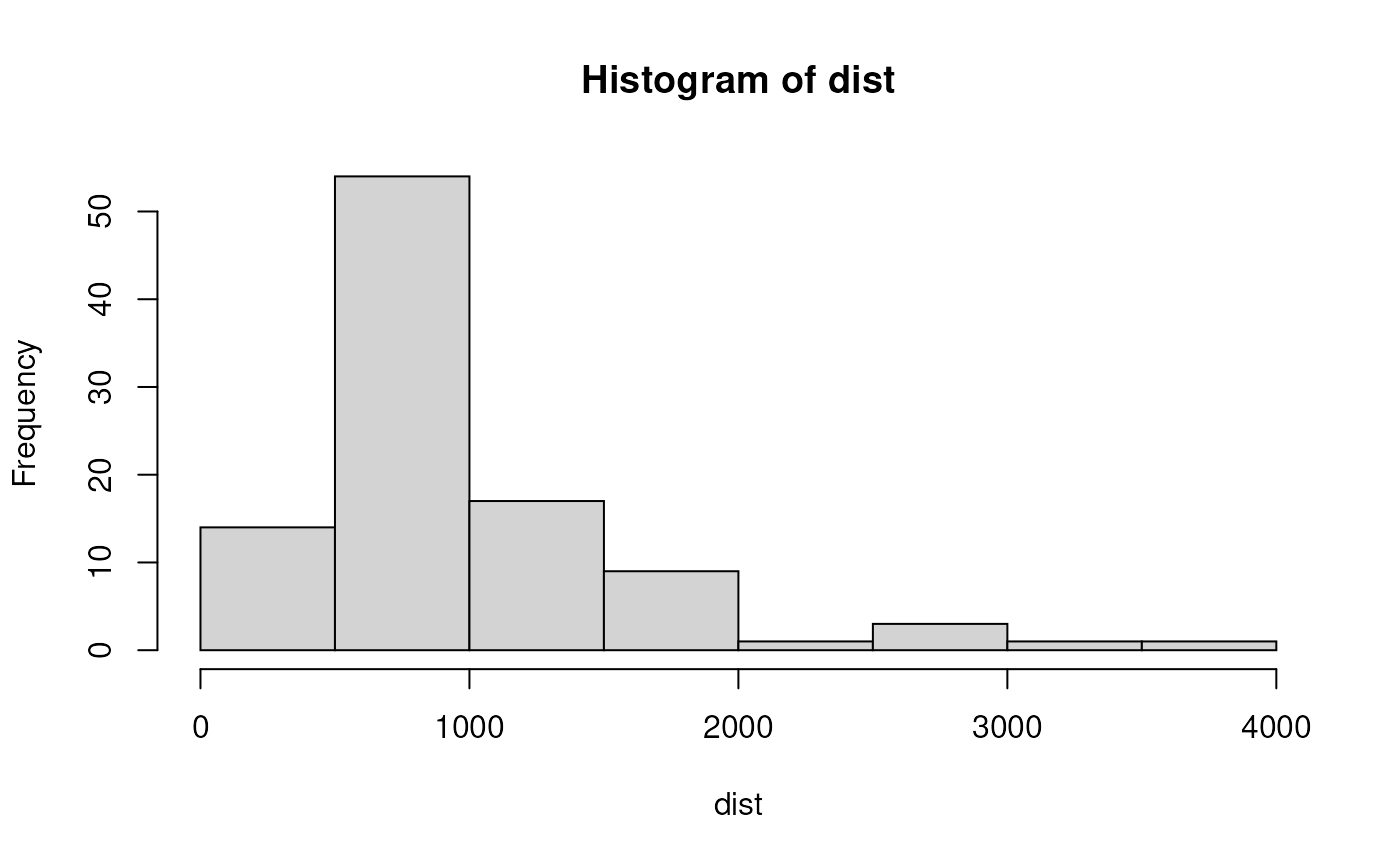
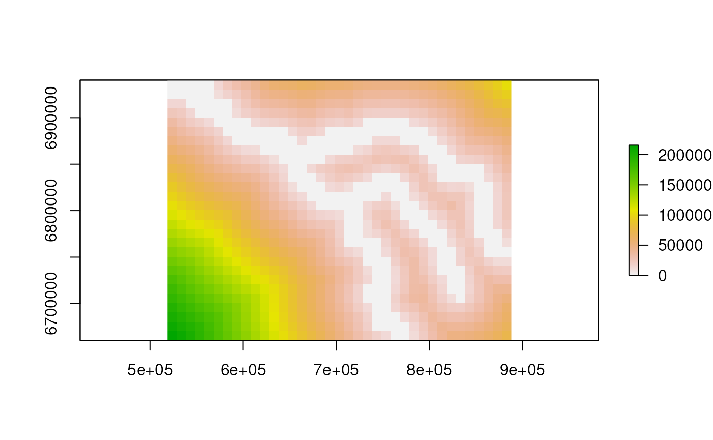
distance_raster
library(raster)
#> Loading required package: sp

rdist <- distance_raster(seine, 1e4)
#> Warning in showSRID(uprojargs, format = "PROJ", multiline = "NO", prefer_proj
#> = prefer_proj): Discarded datum Unknown based on GRS80 ellipsoid in Proj4
#> definition

plot(rdist)